Measuring braided rivers from space: new NZ-US collaboration on SWOT satellite mission
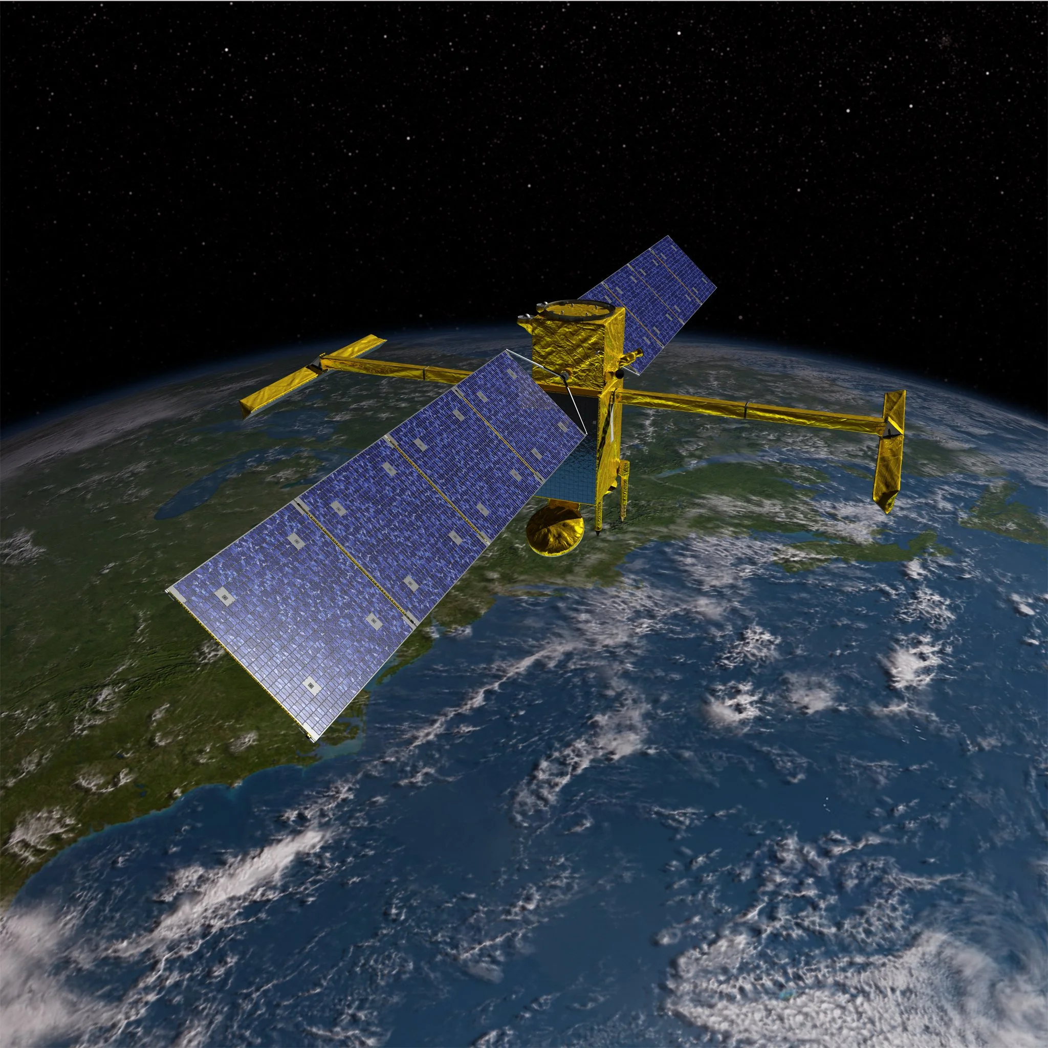
The NASA-Surface Water and Ocean Topography mission aims to provide the first global survey of the Earth’s survey water, providing a critical lens on the storage and flow of water across the surface of the Earth. Using a novel radar sensor, the satellite will measure the width and slope of all rivers wider than 100 m, from which river flows can be estimated using innovative data assimilation and modelling.
The satellite launched from US Vanderburg Air Force Base on the 15th December 2022 and after engineering checks, the sensor payload will begin operational service in April. During its first six months of operation, SWOT will enter a fast-sampling orbit with a 1-day repeat cycle covering just 14% of the Earth. During this phase, a team of international collaborators led by NASA and CNES are planning a global set of field experiments to test the data products derived from SWOT.
James Brasington has been awarded a grant from NASA-JPL to collaborate with the US SWOT Hydrology team led by Tamlin Pavelsky (University of North Carolina) and Colin Gleason (University of Massachusetts at Amherst) to coordinate a three month experiment on the Waimakariri River, which has been selected as one of the 12 ‘Tier One’ rivers to validate SWOT.
This field experiment aims to acquire detailed airborne and boat based measurements of the water surface extent, elevation and slope from a 60 km reach of Waimakariri River as it flows over the Canterbury Plains.
The team will use state-of-the-art infrared and shortwave lidar systems deployed from a helicopter to capture synoptic snapshots of the river at a range of flows to compare to the SWOT observations. At the same time, we are working with Fish and Game to deploy mobile lidar from their jet boat to measure shoreline elevations. In addition to these detailed spatial data we will use acoustic Doppler current profiling to measure the river flow at multiple sections. The net result will be one of the most detailed, spatially and temporally intensive datasets of a braided river globally and unprecedented information to test and constrain the SWOT retrievals.
Ultimately we hope to use the data to better understand how SWOT ‘sees’ complex braided rivers and to develop data modelling tools that can support the analysis of braided and multichannel rivers globally. Locally, our research also holds a key to better quantifying anthropogenic water takes from our large braided rivers in NZ and improved understanding of the exchange between surface water and groundwater. This latter goal is a key focus for a new PhD student, Marissa Dudek, who Tamlin and James are co-supervising and will be joining us for the field experiment next month.
Exciting times ahead!